Creation of an anomaly map using Surfer 7
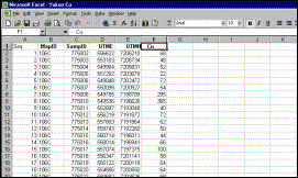
Input data are stream sediment Cu analyses (AAS, 1-gram aliquot, HNO3 digestion) from Central Yukon (GSC Open File 518).
|
Step 1: Original Input Data (all geochemical variables except Cu removed) |
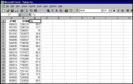
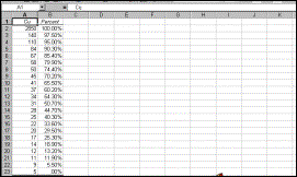
Step 2: Cu values are converted to percentiles |
|
Cu values corresponding
to key percentiles |
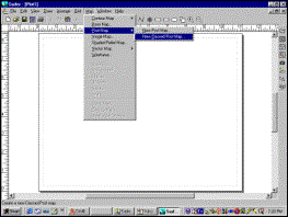
Step 3: Surfer 7 is opened and Map ® Post Map New Classed Post is selected |
|
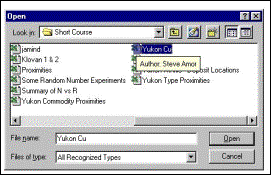
Step 4: Excel file created in Step 2 is selected (Surfer 7 will read Excel 2000 files; for older versions, file should be saved as Excel 3.0 or earlier, or as ASCII) |
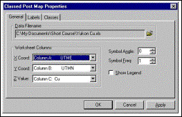
Step 5: Easting (X), Northing (Y) and Posted (Z) Variables are selected |
|
||||
|
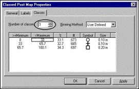
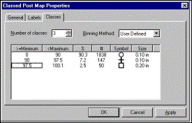
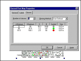
Step 6: Number of classes is selected |
Step 7: Boundaries of classes are adjusted (double-clicking in selected field opens dialog box) |
|||||
|
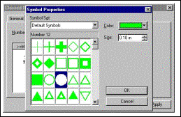
Step 8: Symbol types, sizes and colours are selected. This dialog box is opened by selecting a symbol (see Step 7) and double-clicking on it |
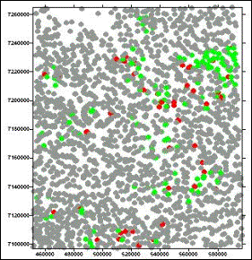
First Try. Circles
slightly too large, northings wrongly aligned |
|
||||
|
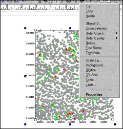
Step 9: Properties
of map are adjusted by right-clicking mouse inside map area, opening
this dialog box and clicking on Properties. |
Step 10: Size of circles is adjusted |
|
||||
|
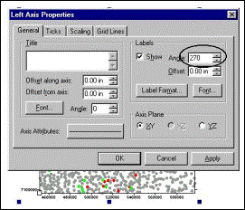
Step 11: This axis properties dialog box is opened by right-clicking the mouse on the axis. The angle (circled) will be altered from 270 degrees to 0 |
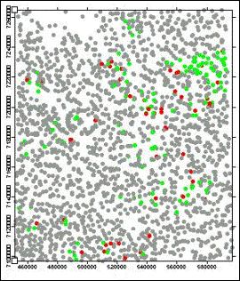
Result. Options exist to
add scale bar, symbol legend, etc., and to import base map if available |
|
||||