 |
 |
 |
Go to Top
Home Page
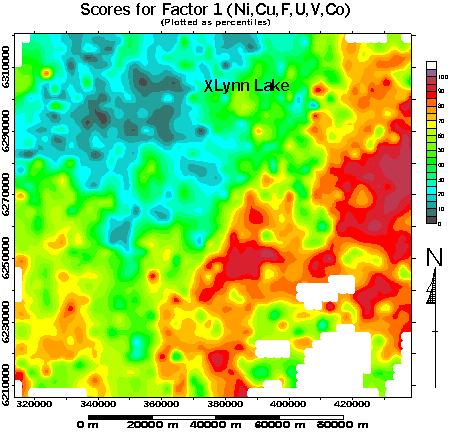
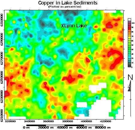
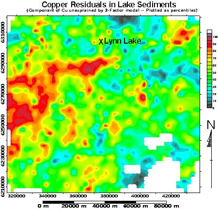
The third map shows that component of the lake sediments' copper content which cannot be explained by this major influence. The features highlighted by the Copper Residuals, as they are called, include the eastern and western portions of the Southern Lynn Lake Greenstone Belt (but not its central portion, and not its northern counterpart) and, in the southwest, the "Transition Zone" between the Sickle System and the Burntwood River Metamorphic Suite, in which numerous copper occurences, of postulated Red-Bed affinity, have been noted.
|
|
|